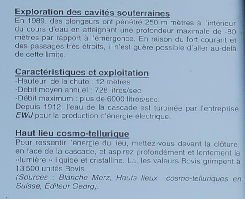
|
Mise à jour le jeudi 5 octobre 2017 |
|
||
| Accueil | Randonnée | Recherche | |
| Source du Jaun | |||
| Station / village | Jaun |
 |
|
| Parking | |||
| Carte interactive | http://map.geo.admin.ch | ||
| Position | 587'628 , 162'042 | ||
| Inventaire | |||
| Dénivellation | |||
| Développement | |||
| Cotation | Visitable par tous | ||
| www.ssslib.ch | www.cavelink.com |
|
|
| Source visitée le vendredi 8 septembre 2017 | |||